Spring fever hit me hard this year, so I decided to go out to Shenandoah National Park for a long run this weekend. I realized that I haven't done any mountain running since my DNF at MMTR 50. Unacceptable!
I planned out a route that would start and Little Devil Stairs and basically do two big loops. The map below is not exactly clear, but you can see the two loops highlighted (big one on the bottom and the smaller one on top). The solid line running across the middle Skyline Drive.
The route would be about 29 miles and called for over 8K feet of climbing. It was an ambitious run, but I didn't mind if I ended up going slower and taking a while. I started out at the bottom right corner of the highlighted route at the Little Devil Stairs trailhead. Litte Devil Stairs is supposed to be one of the toughest climbs in the Shenandoahs. It climbs 1,500 feet in 1.8 miles (15% average grade), and the second half is much steeper and over 25% grade. Seemed like a good way to start a long run.

 I started off at 8:10am and was excited to be back out in the mountains again. This section still looked at least kind of like a trail.
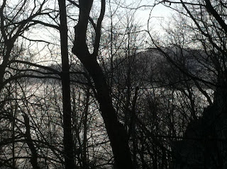
 The forecast called for it to be cloudy until 1pm, which was a bummer. It was incredibly foggy and hazy, making it look like something out of Sleepy Hollow. I was a bit bummed I wouldn't have sunshine for so much of the run.
 As I kept on climbing, it started to look a little bit lighter.


 Another cool waterfall. Getting close to the top now.
 In this angle, you can kind of see the rocky trail I'm climbing towards the right.
 As I got towards the top, the sun was out in full force, and it stayed this way for the majority of the run. I turned onto another trail that was mostly rolling hills up on the ridgeline. I had been lollygagging around enjoy views and taking tons of pictures, so it was time to start doing some real running. Otherwise I'd still be out there on the mountain!

 I hit the Appalachian Trail at the top of the climb and popped out onto Hogback Overlook. When I did the Tuscarora Trail run from the Massanuttens to the Shenandoahs and back, this intersection with the AT was basically the turnaround point.
 More views of the clouds in the valley with mountains just cresting over the clouds.
 Appalachian Trail marker.
 This was further down along the overlook. You can start to see that some of the cloud cover is burning off.

 Then a bit further up is a 93 foot waterfall! This was really cool to see and is the largest waterfall in the Shenandoahs. It was completely dry when Greg and I ran this, so I was surprised to see it!

 From there I crossed back down to the southern loop and had probably a good 11 miles left. Much of this section was rolling up on the ridgeline, and I started to really push the pace. After a few miles on the AT, I turned onto the trail that descended back down the mountain. I flew down this trail, and I think I terrified a few hikers.
I planned out a route that would start and Little Devil Stairs and basically do two big loops. The map below is not exactly clear, but you can see the two loops highlighted (big one on the bottom and the smaller one on top). The solid line running across the middle Skyline Drive.
The route would be about 29 miles and called for over 8K feet of climbing. It was an ambitious run, but I didn't mind if I ended up going slower and taking a while.
 I started out at the bottom right corner of the highlighted route at the Little Devil Stairs trailhead. Litte Devil Stairs is supposed to be one of the toughest climbs in the Shenandoahs. It climbs 1,500 feet in 1.8 miles (15% average grade), and the second half is much steeper and over 25% grade. Seemed like a good way to start a long run. I started off at 8:10am and was excited to be back out in the mountains again. This section still looked at least kind of like a trail. The forecast called for it to be cloudy until 1pm, which was a bummer. It was incredibly foggy and hazy, making it look like something out of Sleepy Hollow. I was a bit bummed I wouldn't have sunshine for so much of the run. As I kept on climbing, it started to look a little bit lighter.
 There were waterfalls all along the climb. With all the recent April showers, the waterfalls were pretty close to peak, which was awesome.
I swear there is a trail somewhere around here.
All of a sudden, I unexpectedly broke out above the clouds. The forecast may have called for clouds all morning, but I figured out that you could solve that by climbing above the clouds! It was really cool seeing the surrounding mountains popping out from the clouds below. I was already loving this run!
Another cool waterfall. Getting close to the top now. In this angle, you can kind of see the rocky trail I'm climbing towards the right. As I got towards the top, the sun was out in full force, and it stayed this way for the majority of the run. I turned onto another trail that was mostly rolling hills up on the ridgeline. I had been lollygagging around enjoy views and taking tons of pictures, so it was time to start doing some real running. Otherwise I'd still be out there on the mountain! I hit the Appalachian Trail at the top of the climb and popped out onto Hogback Overlook. When I did the Tuscarora Trail run from the Massanuttens to the Shenandoahs and back, this intersection with the AT was basically the turnaround point. More views of the clouds in the valley with mountains just cresting over the clouds.Appalachian Trail marker. This was further down along the overlook. You can start to see that some of the cloud cover is burning off. I took the Appalachian Trail to the Tuscarora Trail and then began the northern loop of the run. The trail descended most of the way down the mountain and then connected with the Tuscarora Trail further down close to where it came into the park.
Somewhere in here I ended up taking a 2 mile detour. And just like that this run turned into a 50K! In my defense, I think the map was not quite right for that section. I was also starting to feel a bit out of it in this section. It turned out I was just a bit depleted. I drank a bunch of water, had a gel, and took 2 S-caps. Good as new!
Next was a montrous climb back up to the top. This was the same trail Greg and I climbed back in the fall. The view below looks across the valley to the Massanuttens.
Then a bit further up is a 93 foot waterfall! This was really cool to see and is the largest waterfall in the Shenandoahs. It was completely dry when Greg and I ran this, so I was surprised to see it! From there I crossed back down to the southern loop and had probably a good 11 miles left. Much of this section was rolling up on the ridgeline, and I started to really push the pace. After a few miles on the AT, I turned onto the trail that descended back down the mountain. I flew down this trail, and I think I terrified a few hikers. I was still feeling fantastic and surprised to be running so strong 5.5 hours in. When I got to the bottom, I still had about 3.5 miles left, which I hoped would be flat or downhill fireroads. Wrong.
There were still some big climbs in this section. There were also numerous calf deep stream crossings, which made for very wet, heavy shoes.
I kept on cranking and got myself back to the parking lot around 2:35. I was thrilled with how the run went and couldn't have had more fun out there. It was great to be able to run a tough 31 miles with tons of climbing and feel comfortable the whole time. My stomach was also great, and I downed tons of food and water while out there.
All I can say is that I wish they were all like this!
Next week Jen and I will be in Seattle and Vancouver. Hopefully I'll have some good pictures from hikes and short runs out there.
Comments