Jen and I had an amazing trip to the Dolomites (northern Italian Alps) in the middle of August. We spent 6 days (well four full days with part of a day on each end) hiking about 65 miles of Alta Via 1, one of the main routes that transects the Dolomites north / south.
I was certainly in heaven. I get to hike 65 miles with serious vertical in some of the most beautiful mountains of the world while on vacation. Sign me up! I think Jen was pretty happy about the situation, too. Each day ended up at a rifugio on top of a mountain with panoramic views, hot showers (well, mostly), outstanding food, and good wine / beer. Europeans know how to hike in style!
There was much to document, and I’ll have to do it in a bunch of installments. Before I start though, here is some important advice for anyone who happens to find themselves wanting to do this hike. If you aren't planning to be there anytime soon, save yourself some time and just skip to the pictures.
- It can be really hard to get to the start of the hike! We left our hotel in Venice at 5:45am and were not on the trail until 2:30pm. We took a water taxi to the Venice train station, a three hour train to Cortina, a one hour bus to Cortina (the “Cortina” train stop is not actually Cortina, which was a critical error on my part), a 1 hour bus to Toblach / Dobiacco, and a 25 minute bus to the start at Lago di Braies. Sure, no problem. If you take this same route, don't stress too much about the buses. It is difficult to find information online about the routes / schedule, but it actually was very easy once you got there. The buses run regularly and on time, and drivers are helpful. Just know which towns you need to get to (listed above), and things will work out fine. Also note that the buses typically stop running for 1.5 - 2 hours around lunch.
- Buy the maps of the trail. They are essential! Trails are mostly well marked, but Alta Via 1 meanders around and follows dozens of different trails, and it is rarely marked as Alta Via 1, so you have to know which trail you are looking for. You will need maps 31, 25, and 3. They are available on Amazon, and you may want to have them shipped directly to your hotel, which was much easier for us and less expensive than having it shipped to the US.
- Buy the book "Trekking in the Dolomites." There is almost no literature out there on Alta Via 1. This book is basically it for English speakers. It is not very good, but it is good enough. http://www.amazon.com/Trekking-Dolomites-outline-Mountain-Walking/dp/1852845635/ref=sr_1_2?s=books&ie=UTF8&qid=1346511485&sr=1-2&keywords=dolomites
- If you are going in August, make reservations at the rifugios. Most of them will be booked, and you don't want to be stuck on the trail with nowhere to stay. However, if you find yourself wanting to stop earlier or later than your scheduled rifugio, you may have some options if people cancel at the last minute. Any rifugio you pass will be friendly and helpful about calling ahead down the trail to see if there is any availability. Cancelling is also not a big deal at most, as they will be able to fill your spot. Also note that rifugios somewhat off the beaten path will be less crowded and more likely to have availability. This would be any rifugio not directly on Alta Via 1 and/or not one of the recommended rifugios in the book Trekking in the Dolomites.
It is recommended to cover ~5 miles on your first day, almost all of which is steep uphill. This also assumes you came into the area the night before and started by late morning. We showed up at 2:30pm, and I had planned on us going two rifugios past the recommended stop, which would have taken at least another 2.5 hours. This is what happens when you put me in charge of planning a hiking trip.
The hike up was relentless, but we started to have great views as we approached the top. I was reveling in the mountains, landscapes, and alpine cows. Jen stoically put up with the climbing and all of my reveling.
Near the top of the climb (or so we thought) was a cable aided section (aka via ferrata). Typically one would use a helmet and a harness that hooks into the cable. We didn't have this gear, but luckily this was a short stretch and involved only a bit of scrambling. Further down the trail were some longer, more perilous via ferrata sections, which we would later bypass.
After climbing to the "top" we soon realized there was another 1,000 feet of climbing and a long stretch before the rifugio. When we finally got to the rifugio, it was about 6:15. My schedule of insanity called for another 2.5 - 3 hours of hiking, which would leave us still on the trail as it got dark. We had headlamps, but after being awake since 5:15, this was not an exciting prospect.
Fortunately I was able to save our marriage by getting us the two last spots at Rifugio Biella and cancelling our reservation at the further away Rifugion Pederu. Rifugio Biella fed us well, and we fell asleep early after a long day's work.
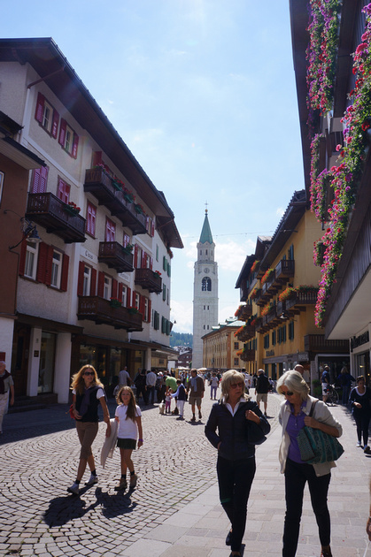
Cortina is a fairly large alpine town and has been the site of world cup ski races, the 1956 winter olympics, and a skiing scene in the James Bond film "For Your Eyes Only."
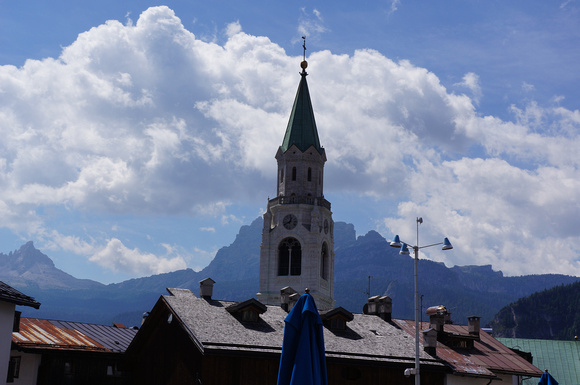
It is a classic alpine town with narrow streets, lots of shops and cafes, and 360 degree views of huge surrounding mountains.
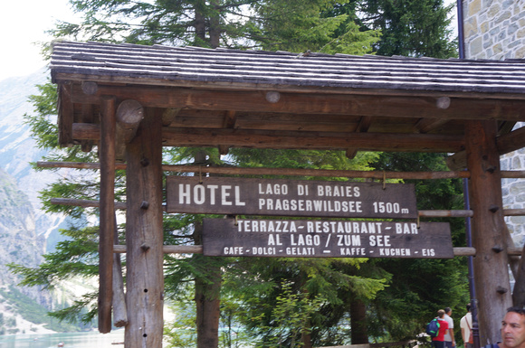
Start of the trail! This is the hotel at the north end of Lago Di Braies.
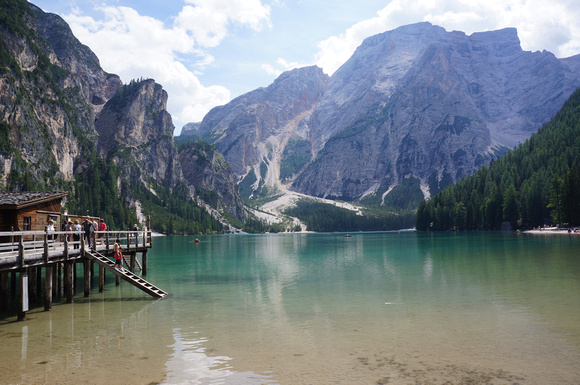
Looking south along the lake. At the other end of the lake in the middle of the picture you can see the sand-colored section that climbs up to the left of the mountain. This is where Alta Via 1 starts climbing.
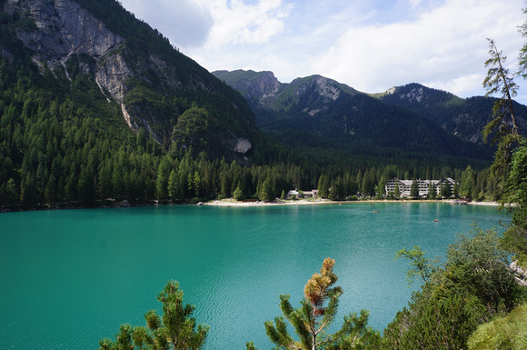
Now at the south end of the lake and looking towards the hotel. The lake is a unique turquoise color.
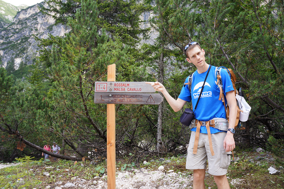
Our first trail sign and major fork in the road. Looking confused here, but it was all good.

Just starting the climb now and leaving the lake in the background

This is a typical trail marker. Alta Via 1 conveniently starts on trail # 1, but this isn't the case for long, and you end up following dozens of different trails.
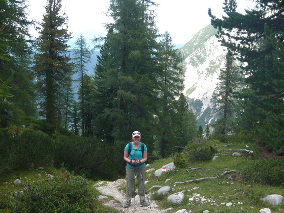
Gaining some altitude, and the scenery is becoming more grandiose by the minute!
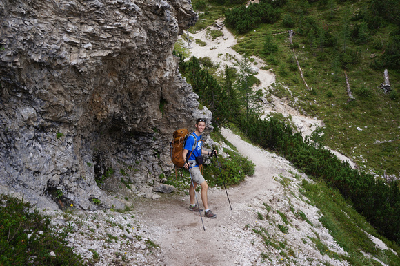
Trekking poles were incredibly helpful with the steep climbs and very heavy pack. Thanks for the awesome birthday present, Mom and Dad!
The trail leveled off to this field after lots of climbing

There were many cows grazing this field, and they looked extraordinarily happy
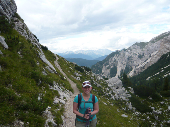
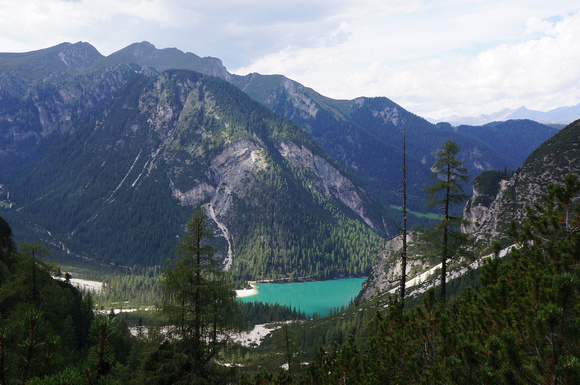
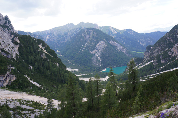
Looking back towards the valley we climbed from. We could now see lots of mountains out in the distance.

We thought we were close, but we had over an hour left with lots more climbing and daylight quickly fading. Poor Jen was wondering what she got herself into with this trek!

We crested a ridge and had the welcome sight of Rifiguio Biella in a high alpine valley a little over 8,000 feet.
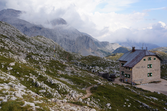
Oh I hope they have a room left! I ran down the trail to sort things out and hopefully have things squared away by the time Jen got there. We really lucked out.
Comments